Sources
Sources for PlayaGo beach guidance
PlayaGo combines named public sources with a beach-level guidance model, so you can compare Tenerife beaches with clearer context before you go.
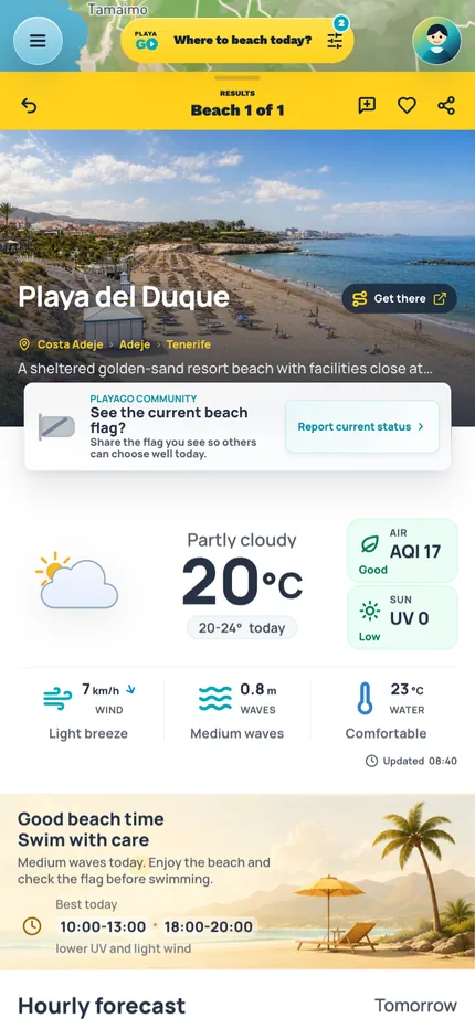
Today's beach recommendations Recommendation The beach choice stays connected to place context.
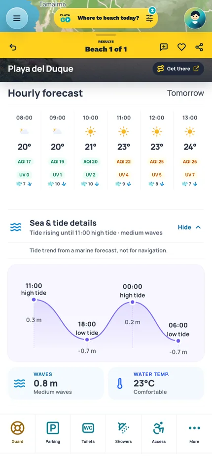
Conditions Weather and sea signals are close to the decision.
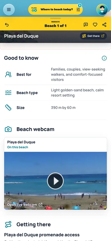
Webcam Live-look links sit beside stable beach facts.
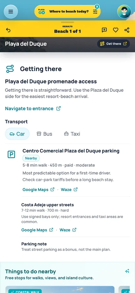
Getting there Arrival notes and navigation links support the beach plan.
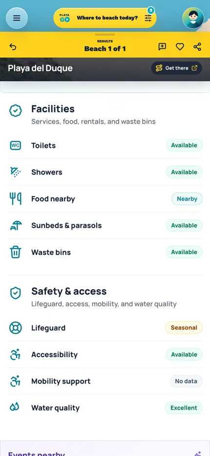
Facilities Services and safety context stay close to the recommendation.
Source providers by role
These are the public institutions, open data services, webcam services, and map/place platforms PlayaGo relies on. They are grouped by how they support beach guidance, live visual context, map display, or nearby next steps.
Independent guidance
Provider names identify the sources PlayaGo references. They do not imply sponsorship, endorsement, or control over recommendations.
Official conditions and safety
Authority sources carry the most weight where weather warnings, bathing-water context, or official beach status matter.
Coverage note
Municipal restriction notices appear on individual beach pages when PlayaGo has a named current source; they are not shown here as a regular provider until coverage is durable.
AEMET
Official authority
Official Spanish weather and beach forecast context.
Direct weather and beach-forecast evidence for beach guidance.
SCS / Gobierno de Canarias
Official authority
Public bathing-water and sanitary beach context.
Bathing-water and sanitary context that can affect beach suitability.
Forecast and geographic inputs
Forecast and geospatial inputs help the guidance understand where a beach sits, how it is exposed, and what conditions are likely.
Open-Meteo
Open forecast service
Coordinate-based weather and marine forecast context.
Forecast input interpreted against each beach's coordinates and exposure.
IDECanarias / GRAFCAN
Geospatial source
Canary Islands geospatial and beach-zone context.
Beach-zone and geography input for location and profile checks.
Beach webcam sources
Public webcam services help you look at a beach scene before you go. They add visual context only and do not set rankings, flags, or safety language.
SkylineWebcams
Live webcam source
Public beach webcam pages and preview images for selected beaches.
Adds visual context on beach pages; it does not determine beach rankings, flags, or safety guidance.
Windy.com
Webcam platform
Live webcam previews and nearby public camera links when Windy coverage is available.
Adds visual context from public webcams; it does not determine beach rankings, flags, or safety guidance.
Map and nearby-place services
These services support map display, place IDs, nearby context, and navigation. They do not decide beach rankings or safety language.
Mapbox
Map platform
Map display and visitor map context.
Display and map interaction support; it does not set safety language.
OpenStreetMap
Open map source
Map and location context for places, coordinates, and nearby checks.
Location and nearby-context support for beach pages and map display.
Google Maps
Map and place service
Google Maps place IDs and directions links for driving, walking, and public transport.
Supports nearby-place context and outbound navigation; it does not determine beach rankings or safety guidance.
How sources become beach guidance
A beach-level decision layer, not another island forecast.
PlayaGo uses public forecasts and official status information rather than replacing them. It combines those inputs with each covered beach's location, exposure, and known profile to explain likely wind, waves, comfort, and suitability. When evidence is incomplete, stale, or safety-sensitive, the recommendation becomes more cautious.
01
Collect
02
Validate
03
Combine
04
Translate
05
Disclose
PlayaGo checks source coverage before translating raw signals into traveler-facing guidance.
What we will and will not claim
Official safety comes first
Beach signs, flags, lifeguards, municipal notices, and official restrictions beat any app recommendation.
Forecasts are not live observations
Weather and wave forecasts explain likely conditions; they are not a promise of what is happening at the water right now.
No paid influence
Restaurants and local partners cannot buy beach rankings, safety language, or recommendation labels.
Gaps stay visible
When a source is missing or a beach has weaker coverage, PlayaGo avoids pretending the data is stronger than it is.
Use the sources in a beach decision
Open Tenerife beaches to compare today's fit with the same source context in mind.